How to Use Google Maps to Plan a Rome Trip
Updated August 2026 · 10 min read
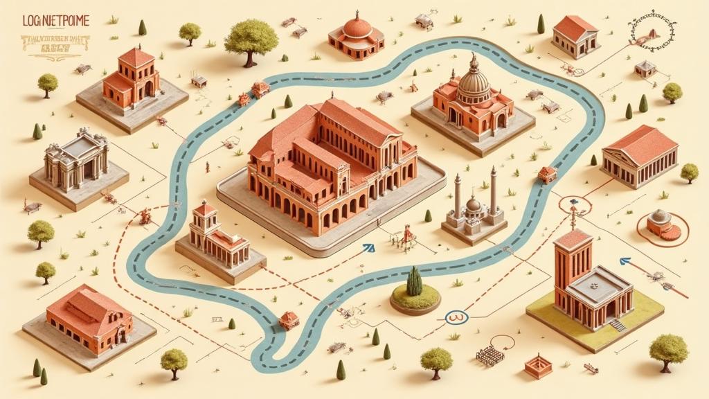
Google Maps is, in our editorial view, the most useful free trip-planning tool for Rome — but most travellers only use half of it. This tutorial covers both sides: Google Maps Saved Lists (fast, phone-first) and Google My Maps (a proper custom travel map with layers, colours and icons). We'll show you when to use each, how to share with a travel partner, and what actually works offline.
If you'd rather skip the setup entirely and start from a ready-made Rome map with 170+ pins, we cover that at the end.
Google Maps Lists vs Google My Maps — which should you use?
These are two different Google tools that often get confused:
| Tool | Best for |
|---|---|
| Google Maps Saved Lists | Fast trip planning on your phone — save places, split by day, reorder, add notes, share with a partner. |
| Google My Maps | A proper custom Rome map with multiple layers, different colours and icons for attractions, food and viewpoints. Built on desktop, viewed on the phone — and mobile viewing is less convenient and less stable than ordinary Saved Lists. |
| Google Maps route links | Turn-by-turn walking directions between ordered stops on a given day. |
For most travellers, start with Saved Lists. If you want restaurants, sights and viewpoints organised into separate colour-coded layers on one map, use Google My Maps instead. The two can happily coexist.
Method 1 — Fast planning with Google Maps Saved Lists
Everything in this method happens inside the normal Google Maps app on your phone. Follow the steps in order.
1. Create your Rome list
Open Google Maps, search a place (say, "Pantheon"), tap Save, then New list and name it "Rome 2026". From now on, every time you research a place, search it, tap Save and choose your Rome list.
Note: Google does not automatically send future saves to this list — you pick the destination list each time. That's a feature, not a bug: it lets you sort into day or category lists as you go.
2. Split attractions into day lists
One giant list becomes noise. Break it into day lists: Day 1 Ancient Rome, Day 2 Vatican, Day 3 Trastevere, and so on. Keep separate Food and Gelato lists too — you'll want them available on every day, not tied to one route.
3. Give each custom list its own icon
Google now lets you customise the icon for lists you created (default lists such as Favorites and Want to Go don't support custom icons). Assign a distinct icon to Day 1, Day 2, Food and Gelato so a glance at the map shows what you're looking at.
4. Put stops into visiting order
Open your list → Edit → turn on Customize list order, then drag places into the order you'll visit. When the day starts, tap through top-to-bottom and use Directions between consecutive stops.
A Rome-specific tip: cluster stops that are within a 10-minute walk. Pantheon → Piazza Navona → Campo de' Fiori is a natural chain. Pantheon → Spanish Steps → Piazza Navona → Trevi is a zig-zag that will burn an hour of walking.
6. Add notes to your pins
Open the place inside your saved list and add a note. Use notes for the things Google doesn't store: booking references, timed-entry slots, which entrance to use, dress code, or the specific dish you wanted to order. On the day, all that context is right there when you tap the pin.
Method 2 — Build a full Rome map with Google My Maps
If you want a real custom travel map — with layers, coloured categories and everything on one screen — use Google My Maps. It's a separate tool from the normal Google Maps app.
- On a computer, open Google My Maps and Create a new map. Name it "Rome Trip 2026".
- Add layers — one per category. A good starting set: Day 1, Day 2, Day 3, Restaurants, Gelato, Viewpoints, Optional. Google My Maps supports up to 10 layers per map.
- Search places, drop them into the right layer, and give each layer its own colour or icon so the map reads at a glance.
- Share the map (or invite editors) so your travel partner can view or contribute.
- Open it on your phone via Google Maps → You → Maps. Your custom map appears there alongside the normal Saved Lists.
Caveat worth knowing: creating and editing a My Map is primarily a browser experience, not something you build inside the mobile Google Maps interface. On the phone, custom maps open in a separate view that is slower and more limited than Saved Lists, and it sometimes takes a reload before the map appears.
Sharing has its own conditions: collaborators generally need a Google account to edit a shared list or map, and what other people can see or change depends on how you shared it (view-only link, invited editors, or public). Check the sharing setting before you assume your travel partner can add places.
Download central Rome for offline use
In Google Maps, tap your profile picture → Offline maps → Select your own map → drag the box over central Rome (Vatican in the west, Termini in the east, Villa Borghese in the north, Testaccio in the south). Tap Download.
What works offline: driving navigation, base streets and basic place info inside the downloaded area. What doesn't work offline: walking, cycling and public transport directions, live traffic and real-time alternate routes.
Important for anyone using a custom Google My Maps map: My Maps requires an internet connection and isn't available offline. Downloading Rome as an offline area gives you offline base streets and basic place data only — it does not download the custom pins from a My Maps map, including any premium or shared map someone sent you. Open your custom map while connected, and keep screenshots or a PDF backup for anything essential — that's exactly why our 170+ Rome map bundle ships as a shareable Google Map and a printable PDF.
Google normally tries to auto-update offline maps on Wi-Fi as they approach expiry, but check the download the day before you fly.
Check entrances with Street View
Rome's landmarks often have entrances that aren't obvious from the map pin. Tap a pin → scroll to the Street View thumbnail and look around to understand the street layout and recognise the entrance area before you arrive. For timed attractions (Colosseum, Vatican Museums, Borghese Gallery), always confirm the current entrance in the attraction's official instructions — Street View imagery can be older than the current access arrangements.
Use walking mode for sightseeing
For central Rome, compare attractions using Walking mode, not Driving mode. Much of the historic centre has restricted vehicle access (ZTL), and driving routes are not a useful way to judge whether two tourist sights are close together. Taxis and licensed hire vehicles are exempt from the ZTL, so they can still get you door-to-door — but that's a separate question from how to plan sightseeing.
Treat Google's walking time as a baseline. Add a little extra for crowds, Piazza Venezia crossings, hills, and finding the correct entrance. On that last point: the pin is not always the entrance. Vatican Museums, Roman Forum, Villa Borghese museums and some archaeological sites have entrances that add several minutes versus the pin-to-pin distance. See our Rome attractions within walking distance guide for realistic times between the major sights.
Use public transport when areas are far apart
Rome has Metro A, B/B1 and C (B1 is a branch of Line B), plus buses and trams. Tap the transit icon on any route for live options. Google Maps can show real-time arrival, delay and service information where the transit operator provides live data — coverage varies, especially on buses. Transit data needs a connection: offline maps don't include it. Screenshot the route if you're heading somewhere with patchy signal.
7 Google Maps mistakes to avoid in Rome
- Don't rely on restaurant ratings alone. Central Rome has tourist traps sitting at 4.4 stars. Cross-check with a food-focused source before you commit.
- Don't trust "popular times" for timed-entry venues. Colosseum, Vatican and Borghese don't reflect their real queues there — book a slot regardless.
- Don't save one giant list. Google supports up to 3,000 places in a saved list, but a trip list becomes visually messy long before that. Our rule of thumb: split by day or category once it stops being readable at a glance.
- Don't skip refreshing offline maps. They expire unless updated — Google usually auto-updates on Wi-Fi, but verify the day before you fly.
- Don't expect indoor navigation. Google Maps cannot reliably route you through the internal paths of the Roman Forum, the Vatican Museums or large parks such as Villa Borghese — use the site's own signage and printed plans once you are inside.
- Don't assume menu labels match ours. Google changes its interface regularly, and wording such as “Saved” or “Your places → Maps” differs between Android, iPhone and app versions. Look for the nearest equivalent rather than the exact label.
- Don't use driving mode for sightseeing comparisons. Central ZTL rules make driving times a bad proxy for walking distance.
- Don't confuse Share with Invite collaborators. Share links only let others view; collaborators can edit.
- Don't assume the pin is the entrance. Check Street View, then confirm in the venue's official instructions.
Don't want to build one yourself? Use a ready-made Rome map
Building a proper Rome map — Saved Lists, day order, My Maps layers, colours — is an evening or two of work. If you'd rather start with a curated map and just customise from there, our Rome attractions map has a free 30+ pin version and a full 170+ version. Both open on your phone and can be accessed from Google Maps. The 170+ version keeps attractions, food, gelato, viewpoints and hidden places organised so you don't have to build the structure from scratch, and it ships with a printable PDF as a true offline backup.
FAQ
Do I need a Google account to use these features?
You need a Google account to create and manage your own Saved Lists or My Maps, to collaborate, and to download offline maps. A shared link may be viewable in a browser without signing in, but editing or saving it into your own Google Maps requires a Google account.
Does offline navigation include public transport?
No. Offline Google Maps supports driving navigation within the downloaded area. Walking, cycling and public-transport directions require an internet connection.
Is a Google My Maps custom map available offline?
No. Google My Maps requires an internet connection. Downloading central Rome as an offline area gives you offline base streets, but not an offline copy of your custom map. Keep screenshots or a PDF backup for anything essential.
What's the difference between sharing a list and inviting a collaborator?
Sharing sends a view-only link. Inviting a collaborator (or enabling editing in Sharing options) lets the other person add and edit places and notes in the same list.
What's the maximum number of pins in one list?
Google currently supports up to 3,000 saved places in a list. That's irrelevant for a normal holiday — split by day or category well before the list becomes visually messy.