Table of Contents
- 1. What it is
- 2. The cartography explained
- 3. The gilded ceiling
- 4. Visiting and photography
- 5. Things to look for
Where to buy Vatican Museums tickets
Try the official Vatican Museums site first, then compare Tiqets, Klook, and Trip.com — trusted booking partners — if official slots are sold out.
OfficialVatican MuseumsFace-value timed tickets from the Vatican's official ticketing site.Official TicketsPartnerTiqetsSkip-the-line tickets and guided tours when official slots are gone.Check PricesPartnerKlookCheck alternative ticket and tour availability.Check PricesPartnerTrip.comBundle Vatican tickets with hotels and city passes.Check PricesWhat it is
A frescoed corridor about 120 metres long and roughly six metres wide, built between 1578 and 1580 by Ottaviano Nonni, called Mascherino, for Pope Gregory XIII. The wall paintings were carried out in less than two years by a team of painters coordinated by Girolamo Muziano and Cesare Nebbia.
The programme was entrusted to Ignazio Danti, the Dominican mathematician and cosmographer. The walls carry cartographic representations of the Italian peninsula and territories connected with the Church; the vault above carries scenes tied to the regions below.
You normally walk it in one direction on the way toward the Raphael Rooms and the Sistine Chapel, though routing can vary on the day.
Source: the Vatican Museums' own page for the gallery.
The cartography explained
The museums describe 40 cartographic representations in total, of which 32 present individual territories in sequence. It is not forty equivalent regional maps: the count includes other kinds of panel alongside the territorial sequence.
The arrangement follows the geography of the peninsula, with the regions of one side of the Apennines along one wall and the other side opposite. Beyond the regional sequence, the official description highlights the four main port cities of the papal world — Civitavecchia, Genoa, Ancona and Venice — together with depictions connected to Malta and to the battle of Lepanto.
Danti worked from the best contemporary surveys and accounts available in the 1570s, and the results are impressive for their date. Read them as a statement about the Church's geography as much as a technical exercise.
The gilded ceiling
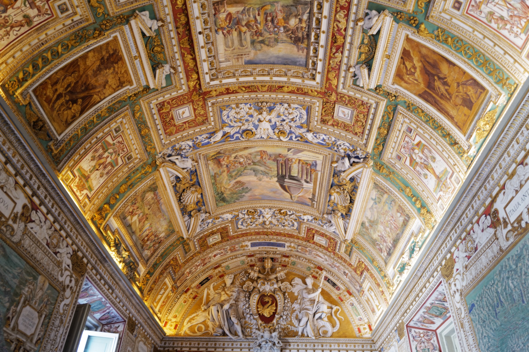
The vault is a continuous programme of gilded stucco and fresco, with historical and biblical episodes linked to the regions mapped on the walls beneath. Most visitors keep their eyes at wall height and miss it entirely. Stop halfway along, step to one side of the flow, and look up.
Visiting and photography
- • Quietest: the earliest slots after the 08:00 opening, or later in the afternoon. The middle of the day is the slowest stretch.
- • Photography: permitted without flash, as elsewhere in the museums outside the Sistine Chapel. There is no time of day that guarantees an empty corridor.
- • Position: stand at one end and shoot down the corridor for the vanishing-point view; the gilded vault usually photographs better than the wall maps.
- • Flow: the gallery is normally walked in one direction toward the Sistine Chapel, but signage and staff direction govern on the day.
Things to look for
- • The four port cities singled out in the programme: Civitavecchia, Genoa, Ancona and Venice.
- • The panels connected with Malta and with the battle of Lepanto, a live memory when the gallery was painted.
- • Ships, coastal detail and decorative flourishes worked into the sea areas of the maps.
- • The junction between wall map and ceiling scene — each region below has its counterpart above.
- • The sheer length of the perspective: the corridor is one of the few places in the museums where the architecture itself is the exhibit.
Frequently Asked Questions
How long is the Gallery of Maps?
About 120 metres, and roughly six metres wide according to the museums' own description. It is one of the longest spaces on the visitor route.When was it made?
The gallery was built between 1578 and 1580 by Ottaviano Nonni, known as Mascherino, for Pope Gregory XIII. The frescoes were completed in less than two years, with the painters coordinated by Girolamo Muziano and Cesare Nebbia.Who designed the maps?
The iconographic and cartographic programme was entrusted to the Dominican mathematician and cosmographer Ignazio (Egnazio) Danti, one of the leading geographers of his day.How many maps are there?
The museums describe 40 cartographic representations overall, of which 32 present individual territories in sequence along the two walls. The remaining panels are of other kinds, not further equivalent regional maps.Are photos allowed?
Yes, without flash, in line with the general museum rule. The Sistine Chapel is the exception where photography is prohibited.Related Vatican guides
Vatican Masterpieces
The don't-miss list.
Gallery of Tapestries
The corridor before the Maps.
Vatican Route Guide
Where the gallery fits in the visitor path.
Raphael Rooms
Usually the next stop.
Full Vatican Museums attraction guide See Rome attractions by area on the map